Satellite imagery technology was back in the news last week after San Francisco’s Planet Labs – recently the recipient of $118 million in Series C equity capital – acquired BlackBridge, the German geospatial value chain business.
Planet Labs is seen as a leader in the sector with the world’s largest fleet of earth-imaging satellites and it caught the attention of a number of big name investors (think Yuri Milner, Founders Fund and International Finance Corp) at April’s Series C round of funding, (which we wrote about here).
It’s also excited the world of ag as a tool to help farmers map their land and monitor their crops; Planet Lab’s agribusiness clients include Wilbur-Ellis, the fertilizer, animal feed and agricultural products marketer and distributor.
The acquisition of BlackBridge includes the five-satellite constellation and six-year archive of imagery of its subsidiary RapidEye, further adding to its arsenal and confirming its strong position in the market, Zachary Bogue, co-managing partner of Data Collective, the Series C lead investor, told AgFunderNews.
“We’re very excited about the RapidEye acquisition because it accelerates our mission of imaging every square inch of the planet every day, while also giving us a rich 6-year archive of global imagery, which will supercharge the Planet platform,” said Bogue, who is on the Planet Labs board.
It is also understood from sources close to the deal that RapidEye was acquired to boost Planet Lab’s agricultural competency due to its near infrared (NIR) sensors. In addition to Planet Labs red-green-blue (RGB) filters, which can measure colours seen by the naked eye, NIR can help analyse crop health further through the normalised difference vegetation index (NDVI), according to Planet Labs. NDVI is a simple graphical indicator that can be used to analyze measurements, such as NIR, to assess whether a field contains live green vegetation or not.
But there are some concerns in the market that even with the addition of RapidEye, Planet Labs has a more limited use for agriculture than the excitement surrounding it assumes.
Ofer Braun, chief executive of Daedulus Systems and Engineering, with experience in developing airborne and spaceborne hyperspectral and high resolution instrumentation, does not believe that images produced by Planet Labs can provide farmers with enough information to warrant the service in an industry where margins are so tight.
“Usually RGB allows for some NDVI analysis which is very popular, but it is also very general,” Ofer told AgFunderNews in an email. “It provides you with some knowledge of the vegetation condition but with no specific indication to its nutrition condition or water condition. For that you would need more channels probably in the shortwave infrared (SWIR) range region.”
But what about RapidEye?
“The addition of the NIR channel does not add more information on the plant. Although it would probably make the NDVI more stable,” he said. “You need to create information usable to the farmer directly and support him in the decision making process. That information may be the amount of nitrogen in the vegetation or the level of water stress. This kind of information requires hyperspectral data.”
Jason Ellsworth, product manager at Wilbur-Ellis and satellite imagery enthusiast, agrees that the images provided by Planet Labs have not yet provided the quality or depth to make it sellable to clients as a product.
“The quality is not exactly what we wanted,” he told AgFunderNews. “But that’s not to say we haven’t used it.”
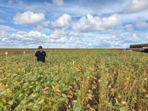
Wilbur-Ellis, one of Planet Labs’ first agriculture clients after the two signed an agreement last November, has started using the imagery in its consultations with clients and has trained up a dedicated team in how to use and interpret the imagery. But it still requires a lot of on-the-ground work, or ‘ground-truthing’ as Ellsworth calls it.
“Some have been critical about RGB, but our idea is to use the imagery to create zones in the field, which we can then ground-truth,” he said. “We split the fields into three zones — low, medium or high — and we might not know what that means, but it allows us to go into the field and work out why this portion is less green. So, we can set boundaries and start treatment in the fields that need it.”
NIR might be able to give some indication of crop stress through NDVI, because it shows the relationship between the red-green-blue that the naked eye can’t see, he added, “but again you don’t know exactly what the crop stress is.”
Despite this, Ellsworth is confident that once Planet Labs is in full operational mode, he won’t have any trouble selling the imagery. “We’ll be able to sell as much as they can give us. The challenge then might be we get too much imagery that we are unable to process each day.”
What then would be the answer? An automated image processing software that can scan images and present specific issues to address. “But before that, we need to find different bandwidths and methods to present more specific problems in the fields,” said Ellsworth. “With just RBG and NIR, we don’t quite have that capability. But it’s not just Planet Labs that hasn’t got there. Noone has. We think Planet Labs is ahead of their game and they have the technology to bring it all together.”
While Ryan Schacht, account executive, agriculture at Planet Labs agreed with Ellsworth that ground-work was needed at this stage, he pointed to the speed of information that Planet Labs imagery can bring to farmers, but also the company’s ability to make changes and developments if needed.
“We can make changes to satellites faster than anyone else,” he told AgFunderNews. “If the industry calls for shortwave or thermal filters, then we are in a position to act faster and provide broader coverage and these are definitely things we are thinking about.”
The acquisition of Blackbridge was not a planned use of the proceeds at the time of the Series C, although the funding gave Planet Labs “the flexibility to be opportunistic whether in the form of strategic acquisitions or hiring or securing launch capability”, said DCVC’s Bogue. “When DCVC decided to lead the Series C we knew that making sure this team is fully funded would lead to exciting things,” he added.
Planet Labs was the first investment in DCVC’s $125 million Opportunity Fund. DCVC has just under $400m under management across its four funds. “We don’t break out our exposure by sector, but we continue to be excited about precision ag as a thesis, as well as broader agricultural applications that have a hard/novel/defensible data problem at the core of the business,” said Bogue.
Would DCVC make other investments in the satellite imagery space for ag?
“Obviously, the lion’s share of deals in this subsector would be competitive with Planet, but if there were a non-competitive deal with a strong technical team working on a hard/novel/defensible data problem in this space, we would certainly take a look,” he added.
So what does the competitive landscape look like for Planet Labs now?
“We continue to feel good that providing 3-5 meter resolution imagery on a frequent cadence is a novel dataset that customers are clamouring to get their hands on,” said Bogue.
While Planet Labs is clearly more developed than most in the sector, there are newcomers, such as Aquila Space, with plans to launch their own constellations of satellites for agricultural applications. Watch this space!
Have news, tips, or want to write a guest post? Email us at [email protected]