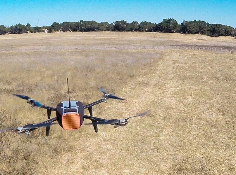
“Anyone can buy a drone and anyone can certainly fly it, but there’s a big difference between doing that and solving a business problem,” Bob Baughman, co-founder at HUVRData, a drone based data analytics company, recently told AgFunderNews.
The recipient of $2 million in angel financing last week, HUVR has now officially launched as a service for agriculture, wind farms, solar farms and the oil and gas sector. It already has clients in the wind farm sector and has been engaged with a rice farming business as a trial customer for several months as it refines its service.
For the rice business, HUVR has been working on three applications: identifying moisture content across big plots of land; identifying the salt content, or salinity, of the land; and counting rice plants on a square meter basis to help the business predict yields ahead of harvest.
“We have now done some test flights for them as they try to determine where their best plots of land are to grow rice, using two different payloads [types of camera]: one of them is thermal and the other is multi-spectral for high-definition imaging and video,” said Baughman. “On the one hand, our clients need the drones to take images, but really they have a business problem and we are using our unique approach and cloud-based expertise, to help solve it.”
These identifications and measurements can help agribusinesses determine the value of land ahead of a lease; understand the situation before harvesting; identify the presence of a red rice, which is a weed impacting yields; move forward with research and definition of new products.
The company prides itself on its cloud-based data platform, which Baughman says takes the service far beyond pure drone-based imaging. And the company is still experimenting with how to use its technology, he said.
Currently, the thermal imaging can identify moisture, and HUVR will upload those images to the cloud for clients to have a permanent record of and for use in discussion with farmers. For the salinity testing, HUVR has partnered with Texas University on research to show that multi-spectral imaging can deduce salinity inside 5 percent.
Rice farming businesses usually rely on manual counts of rice in one square meter plot of land to estimate the yield of a whole property, or large section. HUVR can take a picture of a plot of land and run an algorithm to help count it, reducing governance and accuracy concerns, according to Baughman.
So what about HUVR’s competitors?
Baughman pointed to a range of competitors that are mainly marketing drones to farmers to use themselves, and expressed concern about the complicated nature of the technology and the time burden on farmers where some technologies have software updates as often as every month with complicated instruction manuals.
“I certainly think a farmer can go and buy one, but I think buying into a very early stage technology can be distracting for a business,” he said.
HUVR used the proceeds of its recent funding round, that included commitments from angel investors at the Central Texas Angel Network, Houston Angel Network and the Texas HALO Fund, to hire its first drone pilot, buy its first wave of drone launch vehciles, and to improve its cloud technology to include features suggested by trial customers.
HUVR was one of the first drone companies authorized to fly drones in the U.S. under the Federal Aviation Authority’s 333 exemption, and was granted a blanket Certificate of Authorization (COA) to fly anything under 200 feet off the ground — usually COA’s will be needed for each flight. HUVR has worked closely with the FAA, and continues to do so, to help them perfect the regulatory and application process for drones, according to Baughman. “The FAA has a tough job,” he said.
What does Baghman think are the main obstacles to the widespread use of drones in agriculture?
– Finding the right business model to make drones affordable for agribusinesses so they can take the most value out of it.
– The regulations preventing drones from being flown outside of the line of sight of the pilot, which could enable them to fly over much larger expanses of land. And the cooperation of different country aviation agencies. “They need to find the right balance on how to get out of line of sight, which is a technology, approval and pilot issue. This will be a challenge as an industry to pull together,” he said.
Have news, tips, or want to write a guest article? Email [email protected].
— Visit AgFunder.com for agtech investment opportunities —


