Geospatial technologies like remote sensing, GPS, and GIS have existed for decades, but it’s only recently that they’ve been established as important tools for the future of agriculture and, more importantly, global food security.
With these tools now enabling things like precision agriculture and data-informed decision-making, the time has come to increase and improve collaboration between the historically disparate sectors of agriculture and geospatial in order to develop meaningful answers to some of agrifood’s most pressing problems. Think war, inflation, disrupted trade, and supply chain troubles; all of which are happening as we speak.
Exactly how to do that will be a key topic at this year’s AgTech NEXT conference at the Donald Danforth Plant Science Center in St. Louis, Missouri.
The three-day event will feature a keynote from the 2022 World Food Prize Laureate, Cynthia Rosenzweig, PhD, who is a senior research scientist at the NASA Goddard Institute for Space Studies & the co-located Columbia University Earth Institute’s Center for Climate Systems Research.
The event will also include a panel discussion on the intersection of agriculture and geospatial technologies featuring Pablo Sobron, CEO of Impossible Sensing, Allison Miller, PhD, a Danforth Center principal investigator and professor of biology at Saint Louis University, and Vasit Sagan, acting director of the Taylor Geospatial Institute in St. Louis.
Doing — and seeing — more with less
Sobron, whose company develops optical sensing applications for extreme environments, has a simple way of looking at the intersection of geospatial and ag: “You can see more for less,” he tells AFN.
Traditionally, he explains, measuring elements like soil health or nutrient availability required taking samples from the field to the lab or bringing sensors to the field. Both options are lengthy, costly processes for farmers wanting data that can help them optimize soil quality and, ultimately, crop yield.
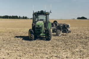
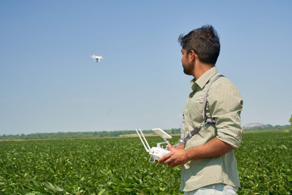
Geospatial technologies like GPS or remote sensing allow farmers to understand much more about their land without having to deal with expensive sampling processes or long wait times. Large swaths of land such as commercial farmland will normally have variations in soil types, nutrient availability, and other factors from one area of the farm to the next; geospatial technologies can tell farmers and growers where these variations are so they can distribute fertilizers, pesticides, herbicides, water resources, and other inputs more efficiently than in the past.
“Either from orbit or even from a high-elevation aircraft, you’re able to see much more, faster and cheaper,” says Sobron.
Andy Dearing, president of Spatial STL Advisors, highlights variable rate planting in row-cropping as an area that benefits from geospatial technologies.
“Growers and producers are trying to figure out how to take data at a micro level and apply it at a macro level,” he tells AFN. “For example, being able to say, ‘I know that this hybrid performs better in this type of condition, and I know this type of condition exists specifically here in this field.’ We’ve got 10 years of yield data to be able to provide that right prescription to that grower and almost guarantee that [crops] will perform a certain way based on the condition types in the field.”
Carbon farming is another area where geospatial tech holds enormous promise.
“When you do no till or cover crop, you could measure certain topsoil properties from space, from orbit, and that is going to allow farmers to really verify the carbon that they’re claiming in the ground,” says Sobron. “Therefore, they can access credit, come on to the [carbon] markets and transparently trade for money from people that want to offset.”
“From a monitoring aspect, you can’t hide anymore,” adds Dearing. “You’ve got satellites taking daily if not hourly pictures of what’s going on [in the field].”
Today’s carbon markets are frequently hampered by inconsistent monitoring and accounting as well as limited amounts of data. Geospatial technologies could usher in more standardization, more accurate monitoring of fields and forests.
Meet me in St. Louis
Situated in the middle of America’s Heartland, St. Louis is in many ways also the point of intersection for the agtech and geospatial sectors.
Sobron says the city has two things no other city in the world has: a heritage of plant science and traction in geospatial intelligence.
In addition to the Donald Danforth Plant Science Center, St. Louis is also home to major agtech companies like Bayer Crop Science, Benson Hill, CoverCress (in which Bayer recently took a majority stake), the Yield Lab, and many others. “It’s a lot of critical mass of thinkers, creative people with knowledge that can actually turn research and innovation into actionable products and services for the for the farmers,” says Sobron.
On the geospatial side, the National Geospatial Intelligence Agency – west and their Moonshot labs at T-REX, the Taylor Geospatial Institute and Saint Louis University have attracted a lot of talent to the city.
“There’s no city that, to my knowledge, has those two big areas that can come together,” says Sobron.
“We have a big national security presence here in St. Louis that does [geospatial stuff] and that’s our foundation, but our next wave of opportunity is agtech dovetailing into that,” says Dearing. “Whether its row cropping or insurance or carbon credits, it’s all got a geospatial component to it. We are actually a really big solution for some of these global challenges when we can take these two clusters and bring them together to help solve those problems.”
Learn more from these and other experts at AgTech NEXT, taking place October 11 – 13. Early bird tickets are available until September 1. Reserve your spot.