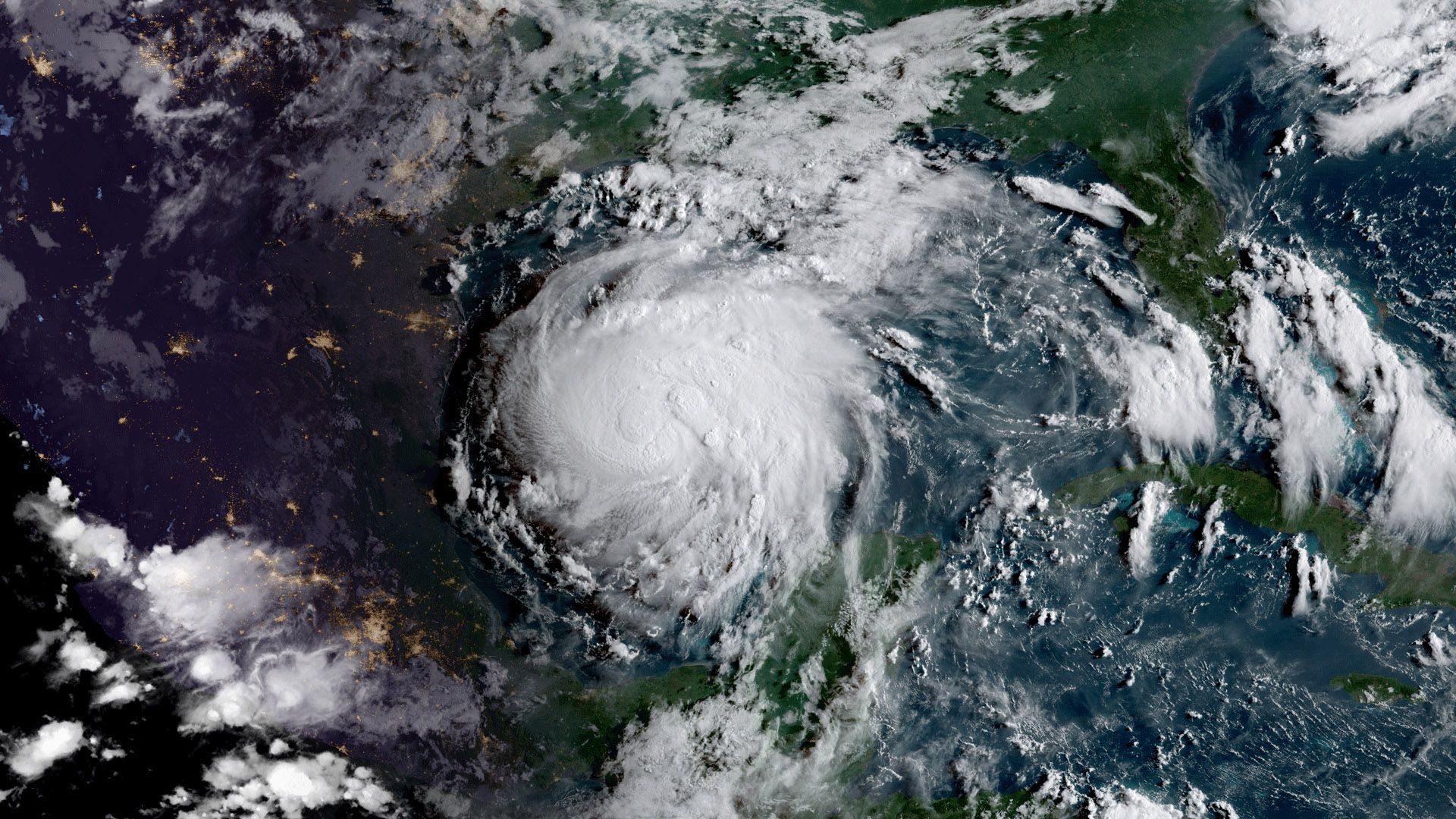
With the devastation of Hurricane Harvey moving on from its starting point of Houston to other areas of Texas and the American South, local businesses are starting to survey the damage wrought by the category 4 storm (at time of landfall) that ripped through the area starting August 25.
Remote sensing has a clear role to play in this surveillance and two companies — a drones service and a satellite imagery company — are turning their technology to help local businesses focus their recovery efforts. Starting by helping energy companies at most risk from flooding and water damage, both businesses are expecting the agriculture industry to come calling before long as the scope of the damage materializes.
Reaching the Unreachable
HUVRData, a drone-based data analytics company headquartered in Austin, Texas has been contracted by major energy companies to inspect electrical infrastructure in and around Houston in the wake of Hurricane Harvey.
HUVRData CEO Bob Baughman told AgFunderNews that it has deployed three drone crews to survey the damage, especially around structures completely unreachable on foot due to massive flooding. Baughman said that HUVRData is part of the “first wave” of drone inspection companies commissioned to inspect crucial infrastructure.
The two-year-old startup’s drones will be surveying the electrical grid at first and will then move on to bridges and physical infrastructure.
“The events of Harvey as you know are unprecedented. The task of inspecting critical infrastructure has just begun,” said Baughman.
Airspace above Houston is extremely restricted right now. Baughman says that any drone photos (like these) or video footage was taken by individuals or news crews with consumer drones. The role of personal drones during Hurricane Harvey has been controversial with claims that they can visually find people in need, and arguments that they can interfere with first responder air traffic.
As of August 29, all drones were grounded by the FAA. HUVRData’s drone flights are being directed by the electrical companies, which he is prohibited by contract to name, and each individual drone flight must be approved by the FAA. Drones will also be used to inspect cell towers and assess insurance claims once drone traffic is permitted.
Based in Austin, HUVRData has been working in the rice industry since 2015, identifying moisture content across big plots of land, identifying the salt content, or salinity, of the land, and counting rice plants on a square meter basis to help the business predict yields ahead of harvest. The company uses thermal and multispectral imaging in its agricultural work and has expanded into industrial asset inspection over the last two years.
Baughman says that so far no individual farmers or agriculture conglomerates have reached out for his services, but he says it’s likely too early for that with the record rains in Houston just recently subsiding. “I would anticipate that as that becomes a priority, we will engage,” said.
Seeing Through the Storm
If drones are performing the micro inspections of elements and structures, satellite imagery is going to provide the macro view of the destruction.
Sky Rubin of Airbus Defense and Space, the satellite imagery arm of the aircraft manufacturer, has been fielding calls and requests nonstop since the start of the storm, mostly from frantic energy industry executives, but he said that the agriculture industry is likely next. Airbus has several different types of satellites including synthetic aperture radar (SAR) that can see through clouds. The company has been continuously capturing images of the affected areas since before the storm in anticipation of requests.
Rubin said he has been getting requests for imagery from several different industries, but the energy industry requests are what he called “desperate,” with so much energy infrastructure unreachable. Rubin said that the company has been giving away a lot of imagery since the storm and is receiving constant requests through their website.
Airbus has a partnership with ag industry analytics company Satshot, a GIS mapping company that analyzes the images that Airbus provides. Rubin said that Airbus’s image sizes and minimum quantities may be too much for some growers and that’s where platforms like Satshot come in. “It gives farmers flexibility and gives them access to the best satellite imagery in the market. It’s one of the easiest tools out there,” said Rubin.
“The key with a storm of this size and scale is having good imagery before and after. We’ve been taking a lot of imagery from many sources to cover agriculture. There is always a chance that we can provide data in an area of distress,” said Nathan Faleide of Satshot. He says that this kind of imagery is of interest not just to growers, but to large agronomy groups, seed dealers, large corporates, and the insurance industry.
“We Don’t Know if Every Farmer Can Survive This”
Gene Hall of the Texas Farm Bureau said that it will be a long time before they will realize the scope of the agricultural damage from the hurricane.
“We know that a lot of farmers were counting on this cotton crop to be the one that keeps them in business. We don’t know if every farmer can survive this. Prices are low and costs are high, and they were counting on significantly improved yields this year,” he said speaking on a Farm Bureau podcast.
Hall explained that though most of Texas’s bumper cotton crop was harvested before the storm, much of it was being stored in the field under tarps. Hall said that about 10% of Texas’s rice crop was still in the fields and it’s unclear how much will be salvageable. Cotton prices have slowly been crawling upward in anticipation of a dip in supply, though experts say this dip may not last.
The USDA has estimated that there are 1.2 million cattle in the 54 affected counties in Texas alone. Cattle futures have also gone up since the start of the storm.
Image Credit: NOAA/NASA GOES Project


