IntelinAir, the aerial imagery analysis company for the agriculture industry, yesterday announced the addition of two board members and some agronomy and robotics experts to its advisory committee. The announcement comes a few weeks after it closed a $3.5 million seed round with Hyde Park Venture Partners, Western Technology Investments, Harvard Business School Angels of Chicago, Holdsworth & Company, HiveFund, and several angel investors.
The two new board members are Mark Holdsworth, operating partner and co-founder of Tennenbaum Capital Partners, a Los Angeles-based private investment firm with approximately $6.5 billion of capital under management, and Peter Lacey, founder and chairman of Cervus Equipment Corporation, a Canadian public company with 2015 sales exceeding $1.1 billion.
Joining the advisory team of IntelinAir is robotics expert Dr. Paolo Pirjanian, founder and CEO of Embodied, a robotics company that is developing intelligent, interactive robots, and agronomist Dr. Harold Reetz, founder of Reetz Agronomics, who led Midwest research and education programs for the International Plant Nutrition Institute (IPNI) for 29 years.
We caught up with IntelinAir CEO Al Eisaian to find out more about the company’s plans.
What are you planning to do with the proceeds of the seed round?
We are hiring quite a number of experts in the area of computer vision and deep learning and product management. Additionally in engineering and product development.
By the end of October our product will be ready as we’ve been testing with a bunch of beta clients and are now gearing up to start selling for the next growing season.
How does IntelinAir’s technology work?
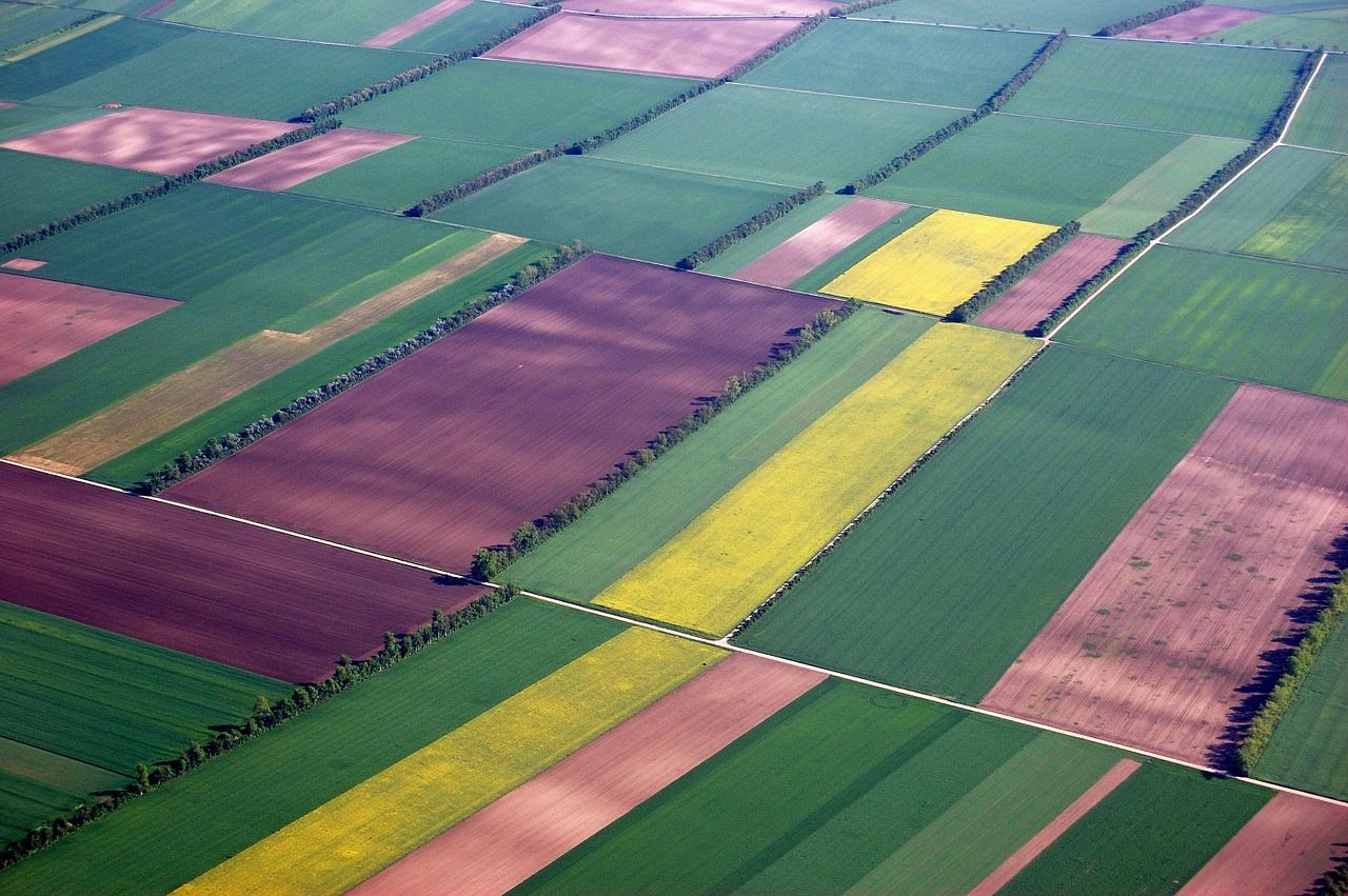
At the highest level, we use aerial imagery analytics to find anomalies that could have an adverse effect on a farmer’s operations and profitability, such as a weed infestation, nutrient deficiencies, weather damages, or insects and fungus. We receive frequent images and process them through our various proprietary algorithms. We look at specific issues that may come up at specific times of the year according to well known growing patterns and timing.
We visualize all of this through an iPad app which provides early warning signals to growers and their consultants so they can address issues more rapidly and to address potential equipment issues or in many cases save on input costs. For example. if they have a weed infestation in one area, there’s no need to spray the whole field. Or if there’s a nutrient deficiency in one specific area of the field, there’s no need to apply fertilizer the whole field. We can also let them know if there’s runoff after rain, and we can help them to count the plant population of their fields so they can measure how many seeds have emerged to make yield predictions. This potentially helps them with marketing their product on a more timely fashion.
What’s your go-to-market strategy?
We are working directly with the largest farmers that have their own agronomists. We’re also working through the retail networks of certain dealerships and cooperatives. So we are more a B2B business, rather than going directly to the smallest farmers. We have also been working closely with several associations to ensure we are addressing the biggest pinpoints for growers. We have also being working with top ag universities that have their own network of farmers, their own research farms. Lastly our marketing strategy is quite focused around counties with the more advanced farmers introduced to us through our partners.
What type of aerial imagery does IntelinAir use and would you ever consider bringing that in-house?
In the MidWest we use high-resolution airplane imagery, whereas in California, where farms are generally smaller, there are a lot of drone companies that are efficient in image capture.
My point of view is that pixel capturing is becoming increasingly commoditized; there are a growing number of image providers for us to choose from. I heard of a company charging just $275 an hour for a fixed-wing flight for an imagery-capture mission. There was another operator with a high-flying fixed-wing drone that captures 50k acres in high-res imagery in a couple of hours. It’s becoming inexpensive. Where the real challenge and value is in absorbing the avalanche of data becoming available from satellites, drones, and airplane imagery, plus the data coming off farm equipment, and then delivering actionable insights. There might be a time when we decide to bring an image capture provider in-house to increase our efficiency, but I’m not sure it will be necessary.
What resolution of imagery do you need?
It needs to be multispectral for our algorithms and about 4-10cm in resolution. We are testing hyper spectral and thermal with our partners, but we’re not ready to discuss those solutions just yet. Satellite imagery, with only 3-5 meter resolution is less useful for the types of problems we are solving but still useful enough as a triggering mechanism.
Satellite imagery is so easy to get and could be useful for a general assessment. But I’ve personally spoken to more than 100 farmers and as a team we’ve spoken to a few hundred over the last year and a half, and they’re telling us they are just not interested in a large number of pretty pictures that they then have to spend time looking through and they just don’t want to pay for it.
Its our fundamental belief that growers want and will pay for reliable, timely and actionable insights. So not just aerial imagery, but aerial imagery analyzed and made relevant to their operations.
