
A drive down some of Ukraine’s yawning roads is a lesson in scale.
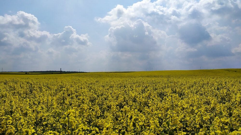
Fields of swaying crops span for miles beneath a blue sky; a view fitting for one of the world’s top grain producers, and underscoring how the Eastern European country earned the nickname “Europe’s breadbasket.”
Just how extensive Ukraine’s farmland is has only recently come to light, thanks to new ways of gathering and crunching satellite-derived earth surface data. A recent study from satellite agriculture service EOS Crop Monitoring revealed that Ukraine is home to 10.6 million acres (4.3 million hectares) of “shadow” farmland, or land that isn’t registered in any government database. The acreage of Ukraine’s unregistered farmland is equivalent to half of the state of Indiana’s landmass, and its output generates an estimated $3.8 billion in untaxed profits.
Such findings, gathered as part of the World Bank’s “Supporting Transparent Land Governance in Ukraine” program, in some ways reinforce a pessimistic view of Ukraine as “Europe’s basketcase.” The country already has a reputation for these sorts of oversights, borne of persistent shoddy governance and widespread corruption. But these results, which can be viewed here, also exemplify how technology can be leveraged to change things for the better, boosting land management transparency and offering key information for investors.
And these results are timely: transparency and data access for businesses are in high demand here as Ukraine prepares for the long-awaited opening of its land market.
Mending the breadbasket
To understand how so many under-the-radar farms have been operating in Ukraine requires a look back at the country’s recent land ownership history. Until the early 1990s, nearly all land property and businesses were state-owned in the former Soviet country. About 75% of farmland was later divided between collective farm workers, with seven million people each receiving two to three hectares.
“In 2001, the [Verkovna Rada, the country’s parliament] adopted a land code to govern land use. However, upon the insistence of some Communist MPs and others, a moratorium on the sale of land was imposed until another law on land market circulation was put in place,” explains Ukrainian economist Ilona Sologoub in an article for the Atlantic Council, a think tank. “Since then, the moratorium has been extended nine times and the second law was never adopted.”
Ukraine is only one of six countries worldwide to ban the sale of private agricultural land. The moratorium prohibits the use of land as collateral, stymying farm growth and development. While actors have devised ways to circumvent the ban, a major consequence is that it “disincentivizes agricultural companies from long-term investment in technology and products with higher value added,” writes Sologoub. “It also keeps rental rates low, which enables inefficient producers to remain in business.”
Ukraine’s land laws seem poised for change now, however. Last November, the Rada adopted a draft law that, if passed, would finally allow private agricultural land owners to sell their plots.
Investors watching from space
An expected result of the government’s land reforms is that international investors will finally enter Ukraine’s landowning fray. Data obtained from companies like EOS and other satellite imagery specialists could prove useful for due diligence purposes. Satellite imagery, as it gets crisper and more granular, should allow the assessment of potential risks and opportunities for investment, exposing crop rotation deviations as well as yield prediction information, for example.
Use cases for satellite imagery in agriculture are widening, as AFN has previously reported. EOS’s agricultural findings in Ukraine follow similar breakthroughs from its mapping projects in Kazakhstan and Azerbaijan, as well as equivalent work in more advanced agricultural markets like the US and UK.
For its Ukraine project, the EOS team say, they have evaluated field sizes, compared them with the government’s official land registry and identified cultivated yet unregistered land. For instance, the project discovered 291,000 acres of rapeseed crop coverage in the Kherson region in the country’s east, an area 33% larger than what is officially recorded.
“Using the product’s machine learning algorithms, the company also defines the cultures grown, the yield stats in different regions, as well as any anomalies in crop rotation,” EOS says. The company says its tools can also “view and assess field state, access historical data on individual areas, as well as their actual size and many other indicators.”
Crop rotation deviation analysis in Ukraine showed that there were other anomalies, like grave violations of proper soil management. In one of the districts, 70% of the land lots for sunflowers had crop rotation violations two to four years in a row.
This kind of satellite intelligence will potentially enable businesses, insurers and consultants working in agriculture in Ukraine and elsewhere to assess potential risks and profits in new ways.
“We are setting a precedent for how satellite monitoring can help markets, businesses and governments. Lots of information, important for growers, investors, and decision-makers in agriculture, can be obtained from space,” Max Polyakov, managing partner of Noosphere Ventures, owner of EOS DA, wrote to AFN. “EOS Crop Monitoring can provide top-notch farmland data in any country, enabling better land and farm management practices and solutions for global food and environment challenges.”
Satellite data-based offerings like these are also a boon for holding governments and large corporations to account, and for developing solutions to environmental and social problems. Ecometrica, for example, is tracing cocoa supply chain corruption, while Satelligence is working to expose palm oil deforestation. Boston’s Upstream Tech is using its BasinScout Platform to collaborate with The Freshwater Trust on water quality and has launched AgTrends to support monitoring, verification and impact reporting using satellite data and machine learning. Initiatives like the Africa Soil Information Service (AfSIS), meanwhile, develop standards and methodologies to use satellites to improve cropland management.
Bracing for impact
In Ukraine, agricultural production has been quietly growing in the last decade, with record harvests recorded last season. (The government’s incomplete land registry data paints a skewed picture of how productive Ukraine’s land actually is, of course.) In the future, with an influx of better agricultural technologies and private capital, yields could further improve. In fact, it needs to, warns Yulia Poroshenko, founder of the Ukrainian agribusiness innovation platform Agrohub.
“Without investment in a qualitative change in the technology of growing grain and oilseeds, there is no chance of success,” she told AFN.
Other geopolitical risks could yet deter outside investors once Ukraine’s land laws change. But the price of land remains low; Poroshenko believes that will encourage an inflow of investor interest.
For farmers and landlords in Ukraine, she adds, they will also need to embrace new data, insights and technology or risk going out of business. “Strategically, the availability of free circulation of agricultural land and market relations will turn this already competitive industry into a space of absolute competition.”
Has your satellite data told you any startling truths about the world? Let us know by dropping a note to [email protected]