Editor’s Note: Igor Ivanov is chief commerical officer of Gamaya, a Swiss agtech startup developing proprietary hyperspectral imaging technology, using drones, to provide farmers insights about their fields. He offers a survey of the leading remote sensing companies.
There are many agtech startups that use remote sensing technology for different precision farming applications. Some try to provide a field-level analysis using drones or airplanes, while others develop large-scale macro analytics using globally available satellite data.
To some extent it is possible to connect airplane or drone-based data with field-level information, and drone-based data with satellite data. Indeed, some of these companies try to combine multiple sources and build intelligence around it.
Though it is entirely possible to group these companies by the crop segment that they serve or their data processing technologies and capabilities, we have decided to focus on the different challenges associated with various data sources.
Here are the most prominent remote sensing companies, sorted by the main source of remote sensing data each uses: satellites, drones, airplanes and ground-based sensors, along with the challenges that come with each data source. (We have excluded companies that focus only on indoor farming from this analysis.)

Satellites offer Big Data but Little Control
Though satellites are an indispensable source of data worldwide, they offer relatively low spatial resolution, which makes it difficult to perform analysis on the plant level. Satellites don’t revisit the same locales often enough to offer daily data, which makes it hard to use the data for short growing seasons, like soybean season in Brazil, though there are some exceptions and Planet Labs claims to have a daily coverage.
Imagery from satellites is also highly susceptible to cloud cover — you can end up waiting for one to two months with no good data due to extensive clouds. Plus, most satellites have only RGB (a basic color spectrum based on the primary colors of red, green, and blue) and/or multispectral cameras, which offer a relatively low amount of information compared to other types.
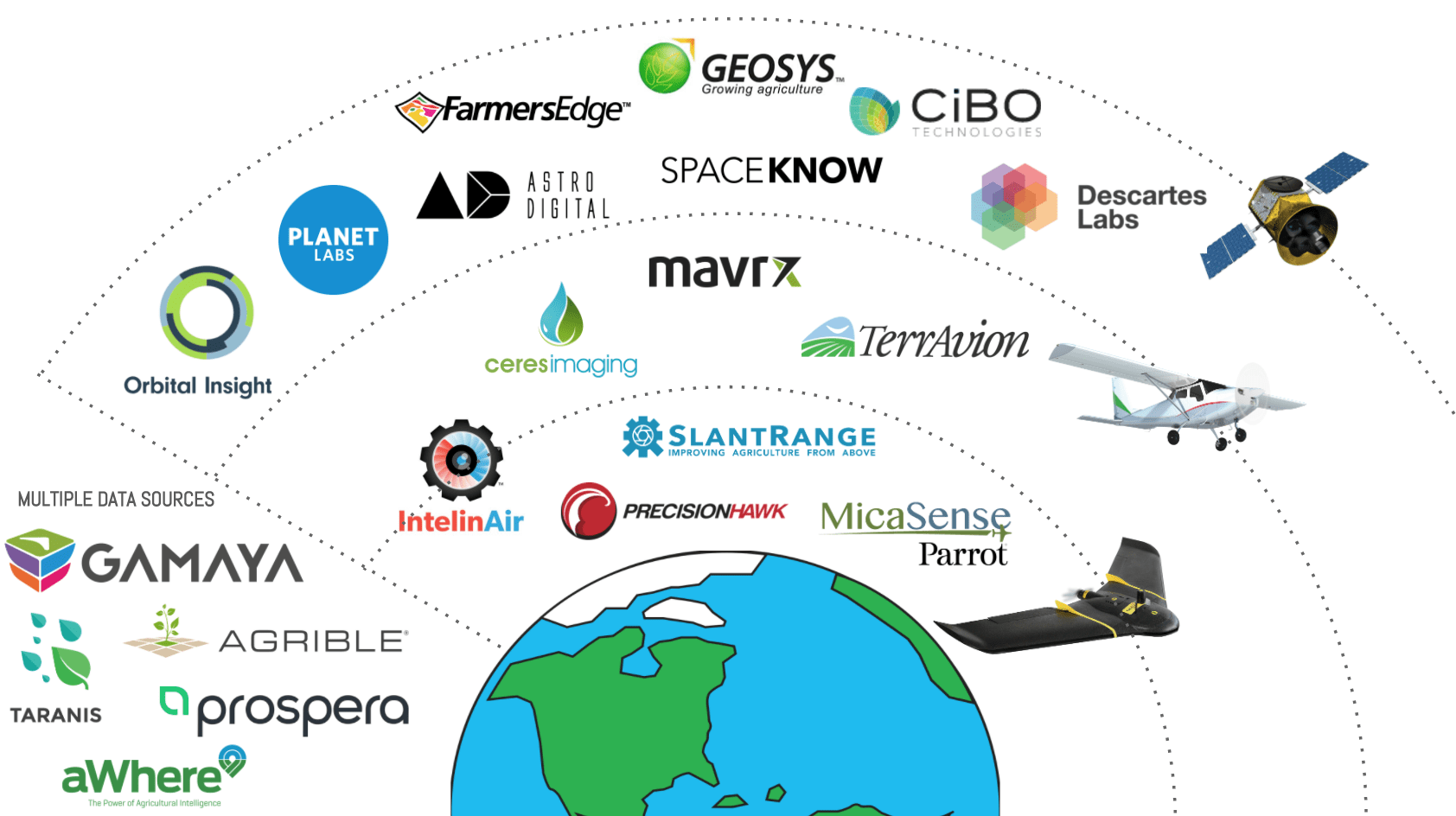
Most notable players which largely rely on the satellite data:
- Descartes Labs – The artificial intelligence and deep learning startup that uses satellite data to make agriculture forecasts mostly for traders, logistics and insurance companies. Currently, the company focuses on corn and soybean crops in US, and provides weekly production forecasts.
- CIBO Technologies – The agricultural technology startup makes data analytics software that aims to improve decision-making in agriculture, mostly on a macro-level (countries, regions, etc.). The company is able to run environmental simulations using multiple sources of data, including satellites.
- Geosys – one of the oldest technology companies that specializes in remote sensing applications for agriculture using satellite imagery. The company provides various products, including variable-rate application maps for nitrogen, day-to-day field performance and benchmarking, variability maps and zoning. Geosys has solutions for insurance and commodity businesses.
- Farmers Edge – The farm management and decision support software company that focuses on collecting and analyzing big data coming from satellites, ground sensors, and machinery. The most popular offering is variable rate applications for fertilizers, such as Nitrogen.
- Orbital Insight – a geospatial analytics startup, that generates macro-level analytics for businesses using satellite imagery and other data. The company address multiple industries, including financial services (i.e. hedge funds), commodities, and agriculture. One of the offerings is tracking of macro-level production flows.
- Planet Labs – the most well-funded company in the category, that images the entire Earth on a daily basis using a large fleet of nano-satellites equipped with RGB and multispectral cameras (via the acquisition of RapidEye). Planet Labs works with precision ag software companies, such as Farmers Edge to distribute the imagery for agriculture.
- Astro Digital – an imaging and analysis company that develops a platform for fast and easy access to satellite imagery. Agriculture is a key sector of focus for Astro Digital, the main product for agriculture is vegetation maps, that the company plans to provide on a weekly basis by the 2018 growing season.
- Spaceknow – Spaceknow develops products for monitoring economic activity for a wide variety of both consumer and enterprise clients, including in agriculture. Specifically, the company monitors agricultural activities on a large scale to make estimations of seasonal yields of commodities to optimize land usage.
Drones and Planes Mean Control and Flexibility But Costs Add Up
Drones and small planes are sources of imagery that offer flexibility and a relatively low barrier to entry, often putting control in the hands of the farmer, but that flexibility is not absolute. Challenges associated with using drones or airplanes include difficulty around scaling for thousands of hectares, particularly for large industrial growers and large areas of land. Drones also need to have a network of drone operators.
Furthermore, they are subject to weather interruptions, which add up to a high level of operational complexity. Drone are also subject to regulations that can significantly limit the usage of drones for commercial operations. It can be difficult to justify the high price of services using a drone or airplane-based data, as data acquisition using drones is quite expensive. On average it can vary from $1 to $5 per hectare per data acquisition.
Most prominent players that rely on the drone or airplane-based data:
- Parrot ecosystem – Parrot, one of the largest producer of consumer drones, has acquired multiple agtech startups, including SenseFly — Swiss company that develops and produces aerial imaging drones for professional applications, including agriculture, Pix4D — a developer of drone photogrammetry software to create professional orthomosaics, Airinov — a French-based company that offers to farmers measure and agronomic recommendation service using drones to support the fertilization of raw crops, and Micasense — a developer of multispectral camera optimized for use in small drones.
- Mavrx – Mavrx provides a visual intelligence platform that uses airplane-based imagery and machine learning to analyze crop growth patterns. Mavrx has a network of 100 aircraft pilots to monitor corn, soy, and wheat production in the US. The solution, that is based on ultra-high-resolution imagery from planes, helps farmers to assess potential problems areas and significantly reduce manual field scouting.
- PrecisionHawk – Precision Hawk offers a fully autonomous drone performing low altitude aerial data collection and subsequent data management and analysis. The company offers an end-to-end aerial data platform, that supports both multi-rotor and fixed-wing drones, and offers a suite of algorithms to produce analytical products, such as volume measurement, canopy cover, field uniformity, etc.
- TerrAvion – The company delivers subscription aerial imagery for agriculture. The core service is called OverView, which delivers subscription imagery, overnight, throughout the growing season. TerrAvion contracts various flight providers, that use small airplanes with an integrated sensor, developed by the company.
- Slantrange – Slantrange is a drone-based multispectral sensor manufacturer and imagery analytics provider using computer vision for agriculture. The company offers different analytical products, such as plant counts, plant size measurements, weed maps, vegetation fractions, and yield potential. Slantrange contracts drone pilots to deliver its services.
- Ceres Imaging – Ceres Imaging specializes in multispectral imaging technology to help farmers increase yields by more efficiently applying water and fertilizer. The company uses custom-built sensors on airplanes to collect the data, and the main product offering includes detection of water stress, chlorophyll content, and NDVI.
- IntelinAir – The company uses multispectral imagery analytics to find anomalies that could have an adverse effect on a farmer’s operations and profitability, such as a weed infestation, nutrient deficiencies, weather damages, or insects and fungus. Using independent imagery providers IntelinAir relies on a combination of high-resolution imagery.
Multiple Data Sources Means More Data, But Can Be Murky
Integrating data from multiple sources is becoming easier and easier with the development of more sophisticated artificial intelligence and machine learning, but challenges persist. Data is very irregular, fragmented, and noisy. Remote sensing data is exposed to environmental effects of weather, clouds, etc. and this requires a sophisticated calibration of data.
Agriculture is a very local, regional and crop-specific industry that should be addressed using custom approaches. Data collection is not standardized, so integrating and managing multiple sources of imagery data is tricky. There are no well-established data standards and different companies use a combination of various technologies to collect the data. Connecting data with internal physiological and biological properties of crops on a plant level is also very difficult, as this requires enormous ground-truthing (empirical evidence from the ground) and agronomic modeling.
Most prominent players that rely on a combination of drone/ airplane-based imagery, space-borne data and ground-based sensors to develop intelligence around it:
- Gamaya – a Swiss-based company that uses a combination of space-borne and proprietary drone-based hyper-spectral imaging data, along with the corresponding historical climate and weather records. Currently, Gamaya focuses on several strategic markets, and provides a crop-tailored solution that includes multiple products from planting efficiency analysis to yield forecasting, weeds detection, detection of nutrients, and beyond.
- Agrible – Agrible develops products and an analytical platform that deliver field-specific data to help with decision making in the agriculture industry. The platform relies on a combination of data sources: machinery-based sensors, satellite imagery, drone-based data and other 3rd party providers. The core offering is the Morning Farm Report, that provides field-level information, such as yield predictions, nitrogen availability, weather forecasts, and more.
- Taranis – Taranis is an Israeli precision agriculture intelligence company, that focuses on the prediction of pests and crop diseases using multiple sources of data, including aerial imagery, sensor-based field and weather data. Taranis also provides field-level local weather forecasts to support the decision-making process of a grower.
- Prospera – Prospera is an Israeli company that develops intelligent solutions for indoor and outdoor farms enabled by computer vision and artificial intelligence. Its focus evolved from detection of pests and diseases for tomato greenhouses to other types of stresses (i.e. nutrient deficiencies) and eventually to outdoor farms. The company uses a combination of RGB cameras, ground-based sensors, weather data and more.
- aWhere – aWhere delivers hyperlocal weather-based agricultural intelligence to growers, commodity traders, governments, and NGOs. The company provides field-level observed and forecast weather, growth stages, plus pest and disease risk using more than 10,000 ground stations and satellites.


